Free Maps Of Lake of the Woods
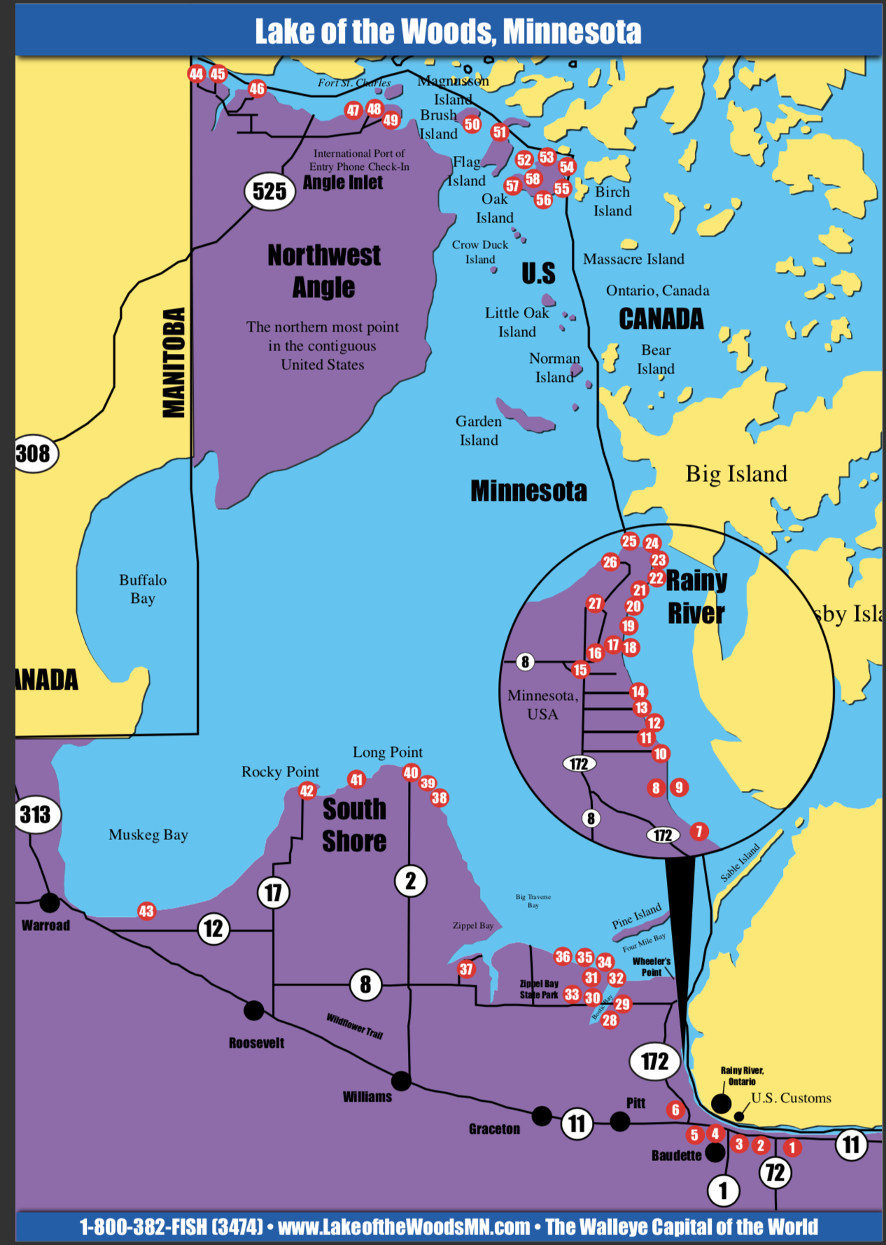
Have you ever read a Lake of the Woods fishing report and wondered where an island or reef being referred to was? With 14,552 islands alone, Lake of the Woods Tourism wanted to provide you with free map resources to use as a reference.
Lake maps are a great way to learn more about the body of water you intend to fish as well as navigation. With a lake the size of Lake of the Woods, using tools like this can add to a safer, easier and more successful adventure on the water.
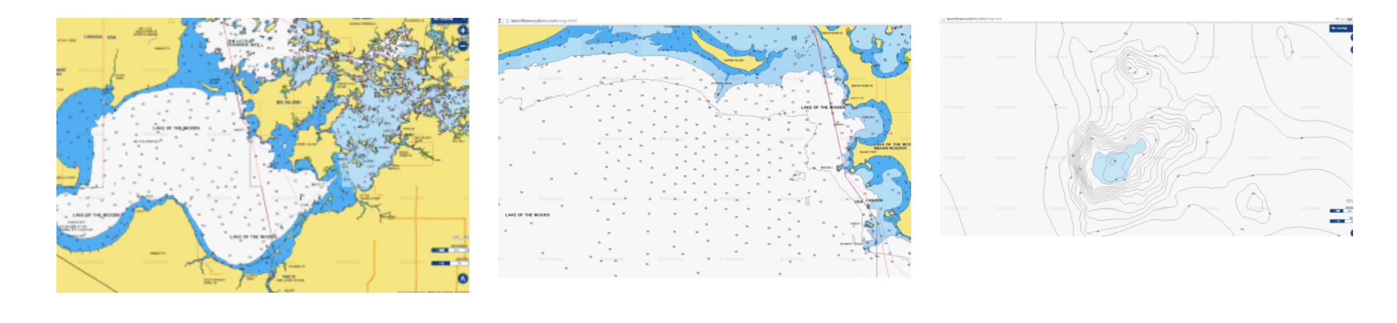
On the Lake of the Woods Tourism website, we have provided you with Navionics interactive map. The lake map is all of Lake of the Woods, both U.S. and Canadian sides. It also shows depths, reefs, islands and more. You can zoom out to get the lay of the land or zoom in to look for a “spot on a spot”. This tool is one you can use at your desktop or on your mobile device anywhere you are connected to the internet to explore the many hot spots of The Walleye Capital of the World.
Mobile app for your phone. Navionics Boating USA app for Android and Apple is $10. This app is very detailed and can be a nice tool to learn more about navigation, fishing spots and actually works as a backup device on the water.
Below are screenshots from the Lake of the Woods Tourism website and specifically the NE corner of Big Traverse Bay around the Knight and Bridges Islands area using the Navionics Lakemap. Click Here to check out the Navionics lake map featuring Lake of the Woods.
Another great map resource is the FREE Lake of the Woods Visitor Guide. The maps in the Lake of the Woods visitor guide break down a specific part of Lake of the Woods. See below. You can view the visitor guide electronically or request a copy to be mailed to you.
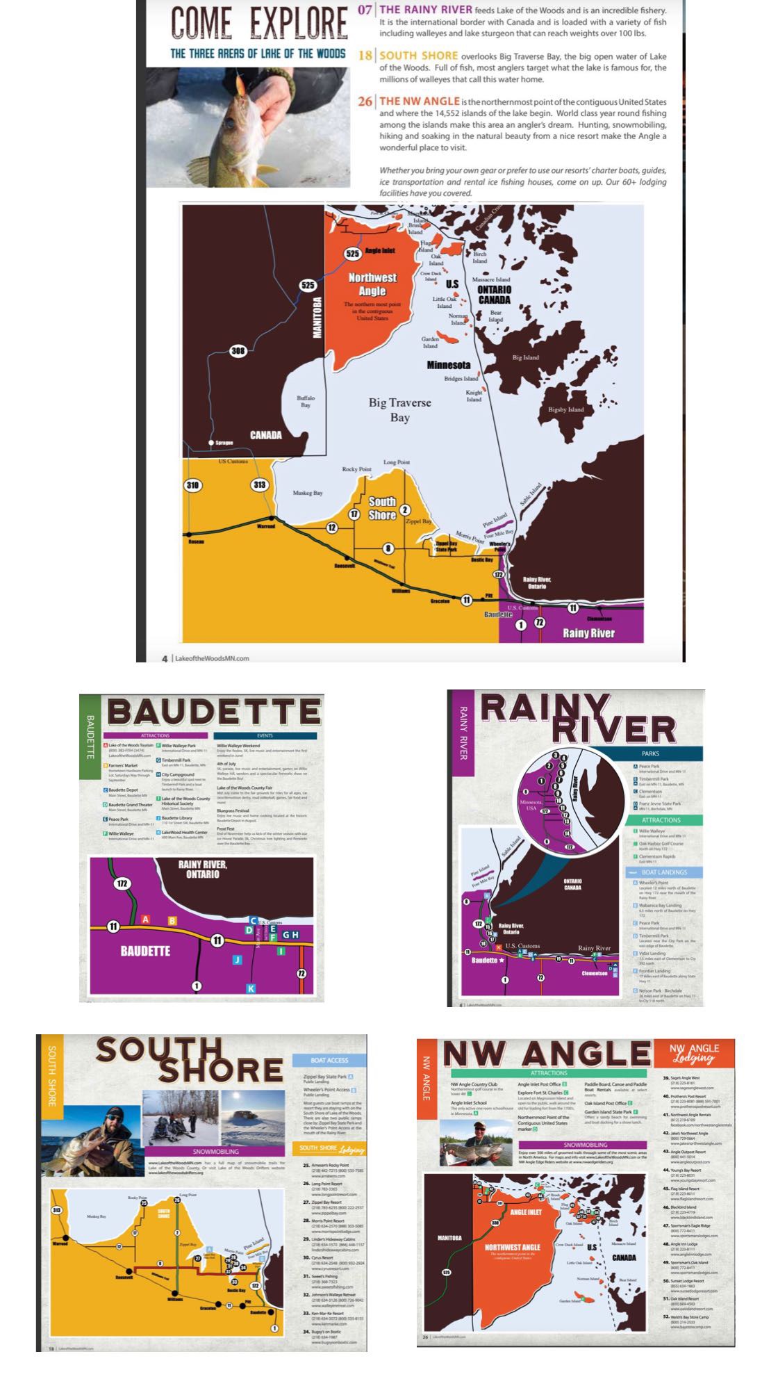
Lastly, if you’re looking for Lake of the Woods lodging we have broken down facilities on a map as well.
A complete list of lodging and ice fishing packages available at www.LakeoftheWoodsMN.com/Lodging.