Plan a Snowmobiling Adventure on Lake of the Woods
It’s that time of year where snowmobile riders start getting that itch again to get out on the snow and ride. Just so happens to be about the time to start making plans to do so. Lake of the Woods and surrounding communities over miles upon miles of riding trails for snowmobilers. Plenty of lodging makes staying and playing easy to be accommodated with.
Enjoy hundreds of miles of connected groomed trails. Our trails are true wilderness trails, as there is less than 5 miles of ditch riding on our trail system. Trails go as far up as the Northwest Angle, as far west as Warroad, south to Waskish and as far east as Big Falls and north up to International Falls.
To the west our trail system hooks up to the Roseau County groomed trails, as well as Kittson County groomed trails and on into North Dakota. To the south we hook up to Beltrami Island State Forest Trails, as well as hundreds of miles of logging trails.
Northwest Angle and Island areas are accessible from Lake of the Woods or the Can-Am Trail by snowmobile. To the east, the Northern Connection hooks up to the 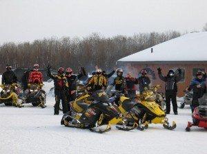 groomed Voyageur Trail West and Arrowhead Trail. Our area is unique by having Lake of the Woods and Rainy River, which both provide ample ice riding.
Some of the trails on this map are funded by the DNR through the Grant-in-Aid program using license fees and gas tax monies. The State of Minnesota, Lake of the Woods County, Koochiching County and private landowners are the people that make our trails possible. The trails on the map cross property of many private citizens, as well as lands which are administered by various levels of government. We owe the landowners our thanks and must respect their property.
Check out our snowmobiling page here for more information!